

Pipeline Monitoring Using Drones
The oil and gas industry faces ongoing challenges in ensuring the safety, integrity, and efficiency of long-distance pipelines. Traditional inspection methods are often labor-intensive, costly, and limited by accessibility issues. In recent years, pipeline monitoring drones have emerged as a transformative solution, offering rapid, precise, and cost-effective surveillance for critical infrastructure. This article explores how unmanned aerial vehicles are reshaping pipeline surveillance, the technologies involved, and the benefits and limitations of adopting these systems.
Pipeline operators are increasingly turning to aerial inspection to address environmental, safety, and operational concerns. By leveraging advanced sensors and real-time data transmission, drones can detect leaks, monitor right-of-way encroachments, and assess potential threats much faster than ground patrols. For a deeper understanding of how control rooms integrate these technologies, see the insights on pipeline control room monitoring.
How Drones Are Transforming Pipeline Surveillance
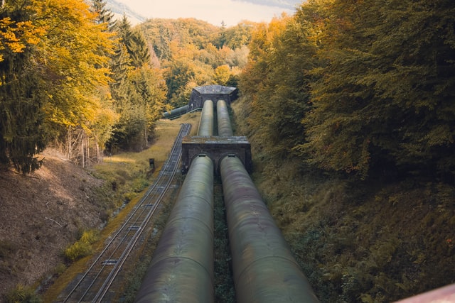
Unmanned aerial vehicles are changing the way companies approach pipeline inspection. Equipped with high-resolution cameras, thermal imaging, and LiDAR sensors, these devices can cover vast distances in a fraction of the time required by traditional methods. Pipeline monitoring drones can fly over remote or hazardous terrain, capturing detailed imagery and sensor data that can be analyzed for anomalies such as leaks, corrosion, or unauthorized activity.
The ability to conduct frequent and systematic inspections helps operators maintain regulatory compliance and respond quickly to emerging threats. Drones can also be programmed for autonomous flight paths, ensuring consistent data collection and reducing the risk of human error.
Key Technologies Used in Aerial Pipeline Inspection
Modern drone-based monitoring systems integrate a range of advanced technologies to enhance detection and reporting capabilities. Some of the most common tools include:
- Visual Cameras: Capture high-resolution images and video for visual inspection of pipeline surfaces and right-of-way areas.
- Thermal Imaging: Detects temperature anomalies that may indicate leaks or insulation failures.
- LiDAR Sensors: Generate precise 3D maps of terrain and infrastructure, useful for identifying ground movement or subsidence.
- Gas Detectors: Specialized sensors can identify the presence of hydrocarbons or other gases, providing early warning of leaks.
- AI and Machine Learning: Automated analysis of imagery and sensor data helps identify patterns or anomalies that warrant further investigation.
These technologies, when combined, enable a comprehensive approach to pipeline surveillance, improving both detection rates and response times.
Benefits of Drone-Based Pipeline Inspection
The adoption of aerial monitoring offers several advantages over conventional ground-based approaches:
- Speed and Coverage: Drones can inspect hundreds of kilometers in a single flight, reducing inspection cycles from weeks to hours.
- Safety: Remote operation minimizes the need for personnel to enter hazardous or inaccessible areas, lowering the risk of accidents.
- Cost Efficiency: Reduced labor and vehicle costs, along with less downtime, translate to significant operational savings.
- Data Quality: High-resolution imagery and sensor data provide a more detailed and objective record than manual inspections.
- Environmental Protection: Early detection of leaks and encroachments helps prevent environmental damage and regulatory penalties.
These benefits are especially critical in regions where pipelines traverse challenging terrain or sensitive ecosystems. For more on the risks posed by leaks to communities, see the article on pipeline leak community risks.
Challenges and Limitations of UAV Pipeline Monitoring
While the advantages are clear, there are also challenges to consider when implementing drone-based monitoring:
- Regulatory Compliance: Operators must adhere to aviation regulations, which may restrict flight paths, altitudes, or require special permits.
- Weather Dependency: Adverse weather conditions such as high winds, rain, or fog can limit drone operations and data quality.
- Data Management: Large volumes of imagery and sensor data require robust storage, processing, and analysis systems.
- Battery Life: Flight duration is limited by battery capacity, potentially requiring multiple flights or drone swaps for long pipelines.
- Integration: Effective use of drone data depends on seamless integration with existing asset management and emergency response systems.
Despite these hurdles, ongoing advances in drone technology, sensor miniaturization, and artificial intelligence are steadily overcoming many of these barriers.

Leak Detection and Environmental Protection
One of the most crucial applications of pipeline monitoring drones is the early identification of leaks. By using thermal cameras and gas sensors, drones can spot subtle changes in temperature or gas concentrations that may indicate a breach. Early intervention is essential to minimize environmental damage, protect wildlife, and avoid costly cleanups. For a closer look at the impact of leaks on ecosystems, refer to the discussion on pipeline leak impact on wildlife.
In addition to leak detection, drones can monitor for illegal construction, vegetation encroachment, or erosion along the pipeline route. This proactive approach helps operators maintain compliance with environmental regulations and reduce the risk of incidents.
If you are interested in learning about the warning signs of potential leaks, the article on signs your pipeline is leaking provides valuable information for both operators and the public.
Integrating Drones with Broader Pipeline Management
To maximize the value of aerial inspection, drone data should be integrated with other monitoring systems such as SCADA, ground sensors, and control room analytics. This holistic approach enables faster decision-making and more effective emergency response. For example, when a drone detects a potential issue, operators can quickly dispatch ground crews or shut down affected sections to prevent escalation.
Drones also support disaster preparedness by providing real-time situational awareness during emergencies. For more on planning for pipeline incidents, see the resource on pipeline disaster preparedness.
Furthermore, integrating drone data with agricultural and community risk assessments can help operators better understand and mitigate the broader impacts of pipeline incidents. Insights into how leaks affect farmland are available in the article on pipeline leak impact on agriculture.
Future Trends in Pipeline Surveillance Technology
The future of pipeline inspection is likely to see even greater reliance on unmanned systems. Advances in battery technology, sensor miniaturization, and autonomous navigation will extend flight times and improve data quality. Artificial intelligence will play a growing role in automating data analysis, enabling real-time alerts and predictive maintenance.
Regulatory frameworks are also evolving to accommodate the increased use of drones, with many countries developing guidelines for beyond-visual-line-of-sight (BVLOS) operations. This will further enhance the efficiency and reach of aerial monitoring programs.
As these technologies mature, pipeline operators can expect even greater improvements in safety, efficiency, and environmental stewardship.
Frequently Asked Questions
- How do drones detect pipeline leaks?
- Drones use a combination of thermal imaging, gas detection sensors, and high-resolution cameras to identify temperature changes, gas emissions, or visible signs of leaks. These tools enable early detection and rapid response to minimize damage.
- Are drone inspections more cost-effective than traditional methods?
- Yes, aerial inspections reduce the need for large ground crews and vehicles, lower operational risks, and allow for more frequent monitoring. This results in lower overall costs and improved data quality.
- What are the main limitations of using drones for pipeline monitoring?
- Limitations include regulatory restrictions, weather dependency, limited battery life, and the need for robust data management systems. However, ongoing technological advancements are addressing many of these challenges.
Pipeline monitoring drones are rapidly becoming an essential tool for the oil and gas industry, offering a safer, faster, and more effective way to protect critical infrastructure and the environment. As technology continues to advance, their role in pipeline management will only grow in importance.